Vente de matériel aéronautique
- Atelier agréé PART 145 FAR 145
- 04 42 38 66 30 Aix-En-Provence
04 67 29 33 80 Montpellier L'Or - contact@seamavionic.com
- Une équipe à votre service
BlueChart Atlantic
010-10318-00
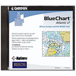
BlueChart marine maps, Garmin's exclusive line of marine maps, provide interactive, detailed nautical chart data and innovative object-oriented cartography.
These detailed electronic nautical charts look like paper charts when displayed on your compatible Garmin chartplotter or handheld.
For a list of recommended products for BlueChart Atlantic, see the product compatibility table located in the upper right-hand corner of the BlueChart Atlantic page.
- Includes realistic navigation features that show everything from shaded depth contours and coastlines to spot soundings, navaids, port plans, wrecks, obstructions, intertidal zones, restricted areas and IALA symbols.
- Contains updated coverage of Africa, Europe and the Middle East.
- Includes port services for Norway, Sweden and Italy, and detailed coverage of Iceland.
- Compatible with HomePort software that lets you use BlueChart data to conveniently plan and organize routes from your computer before your trip.